True color LANDSAT image of Saih Hatat. Image shows
a structural dome of carbonates, which have been eroded to create a window
into the metamorphic basement. A small portion of the ophiolite is
located in the southwest corner of the image. The map by Gregory,
Gray, and Miller is shown below.

Map by Gregory, Gray, and Miller showing the complex
lithologic and stuctural relationships within the Saih Hatat.

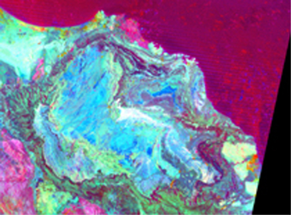
Sultan's Combination of the smae area illustrates that
mineralogical differences in the rocks of Saih Hatat make a significant
difference in their spectral reflectances. Although mapping as detailed
as above could not be done by remote sensing alone, the image below provides
an appropriate means by which to check ground based interpretations.